
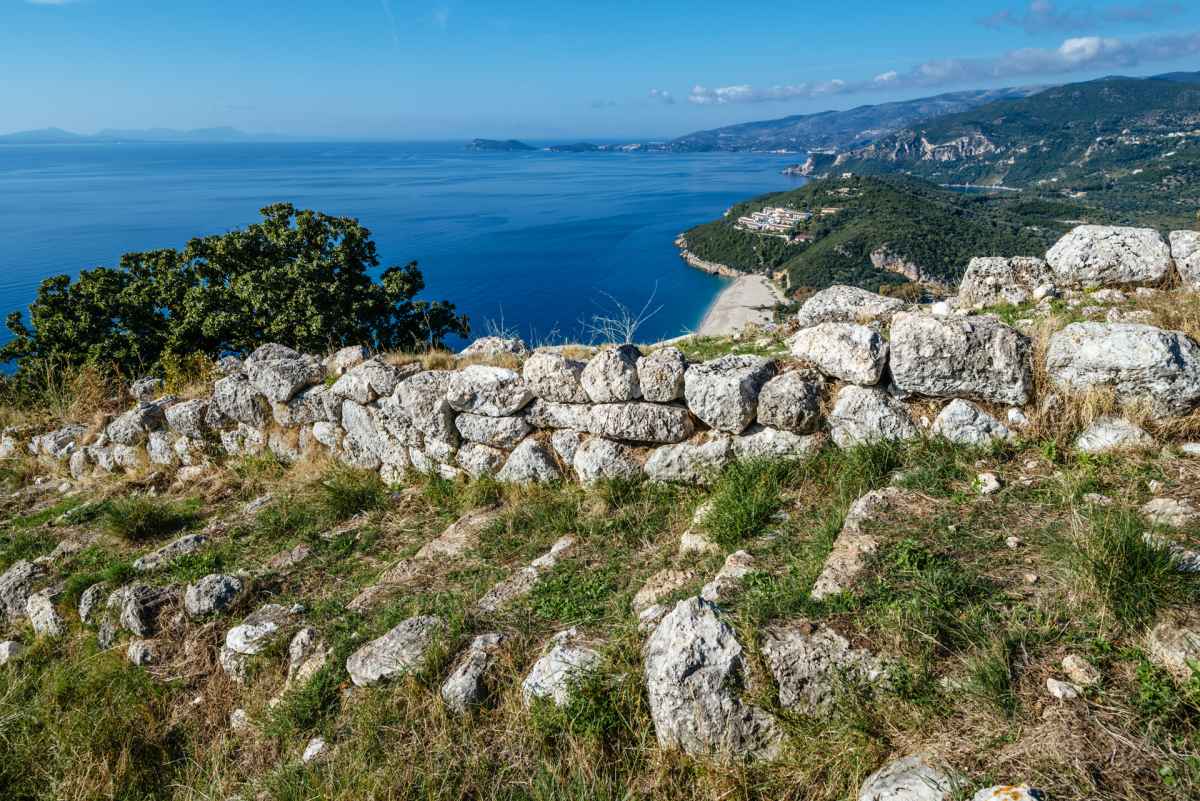


Dimokastro, ancient Elina, is located over Karavostasi bay of Perdika Thesprotias. This location was ideal for the control of the south Passage of Corfu and the small seaside plain. The settlement is spread out over 220 acres and is comprised of three separate parts that develop successively along the hill και are defined by fortifying precincts. Dimokastro saw its greatest prosperity during Hellenistic times. The ancient settlement was destroyed by the Romans in 167 B.C. along with all the other big cities of Thesprotia. However, it seems it wasn’t completely abandoned since there have been limited findings of inhabitation during the Roman rule.
Elimokastro, Elinokastro or Erimokastro are some of the more recent names of the ancient settlement of Dimokastro which is found on a hill over Karavostasi bay of Perdika. The identification of the settlement with the ancient city of Elina was made by professor of Classic Archaeology Sotiris Dakaris. The ancient place name Ελίνα was also found on a leaden inscription of the 3rd century B.C. from ancient Dodoni.
The establishment of the city at an area of 220 acres took place during the second half of the 4th century B.C., a time when the people of Thesprotia first settled together in organised cities. Its favourable geographical location ensured control over both marine routes and the wider region.
The city was divided in three terraced plateaus (“Citadel Α”, “Citadel Β” and “Citadel C”) and three precincts that developed successively along the hill. It is estimated that at its heyday the population reached 4.000-6.000 inhabitants.
The settlement was surrounded by fortification, with the exception of the southern side that is inaccessible and was only protected at its open spots. The defensive capacity of the fortification was strengthened by towers and arches. The fortifying precinct of Dimokastro had many main gates that served for the connection with the ancient port, the area between the settlement and the sea and the cemetery.
Inside the walls, residential development was determined by the natural formations of the land. The settlement was developed in terraces and had a network of roads. There is no clear organisation of public spaces in Dimokastro. There were however, some public buildings, such as the loggia used for commercial activities and two places of worship: one of them comprised of two ‘twin’ rectangular buildings-parts of a wider religious complex. The second comprised of a rectangular edifice of a three-part internal division and two auxiliary rooms.
“Citadel Α” was the most structured part of the ancient settlement and also its residential and administrative core. In the center there was a large rectangular patio, with loggias and rooms with columns and floors made of seashells.
Dwellers of the settlement showed great care about the water supply and drainage, as can be proven by cisterns for the accumulation of rain water as well as the drains made of stone or clay. In their majority, cisterns were carved on the rock.
The ancient settlement was destroyed by the Romans in 167 B.C. In contrast to other cities of Thesprotia that were also destroyed, Dimokastro seems to have still been inhabited, albeit at a smaller scale during the Roman rule.


